


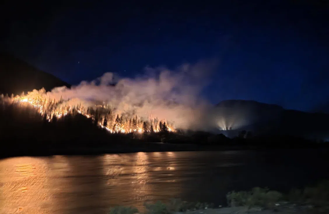
Picture of the Nikaia Creek wildfire late evening on Monday, June 30, 2025/via Kristi Kiki Raphael on Facebook
The Thompson Nicola Regional District has initiated a Local State of Emergency and issued its first evacuation orders of 2025 wildfire season.
The State of Emergency covers Area “I,” which includes a geographically and transportation-isolated area on the west side of the Fraser River at Lytton.
“The Thompson-Nicola Regional District has declared a State of Local Emergency for Electoral Area “I” (Blue Sky Country) due to the Nikaia Creek wildfire,” said the TNRD in a statement Tuesday morning.
“This declaration enables prompt coordination of action or special regulation of persons or property to protect the health, safety, or welfare of people or to limit damage to property.”
“The emergency powers are used to order of evacuation of residents from their homes, prohibit travel, and/ or enter private property when an emergency threatens lives, property, or the environment within the TNRD’s jurisdiction,” noted the statement.
A pair of households on the west side of the Fraser River from the Village of Lytton have been ordered to leave.
This is due to the now-named Nikaia Creek fire, which took hold on Monday night — the 4-year anniversary of the deadly fire which destroyed much of the Village-proper.
The Lytton First Nation has also issued evacuation alerts for its residents in the same area.
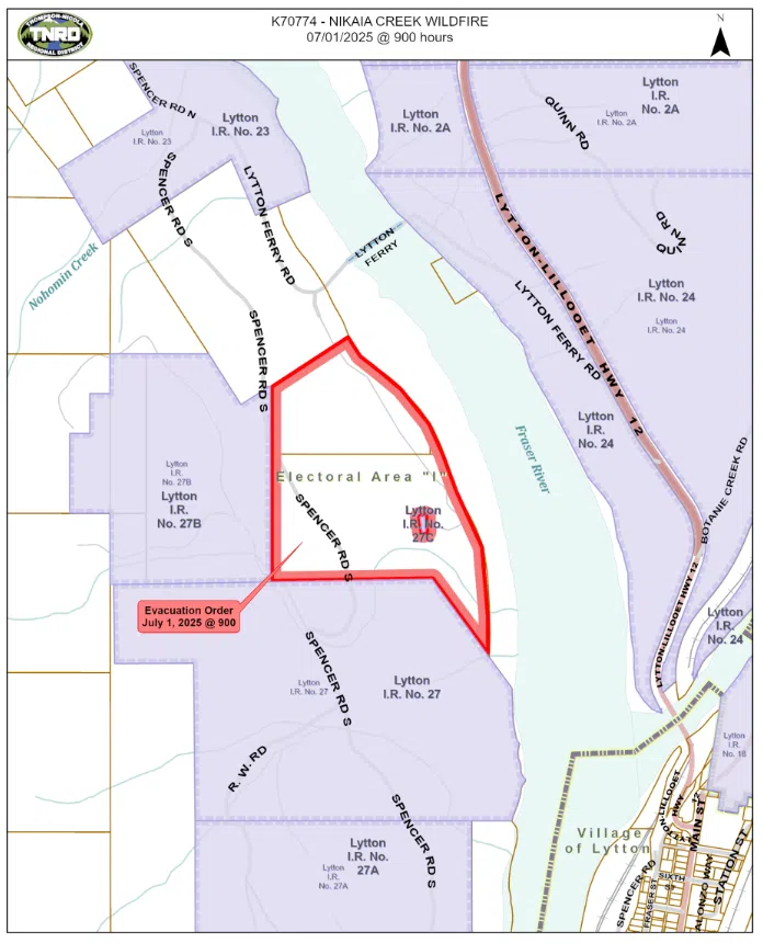
CLICK to expand map of Evacuation order issued by the Thompson Nicola Regional District on Tuesday morning/via TNRD
The Nikaia Creek wildfire started taking hold Monday night in an area not far from the Lytton Ferry crossing.
No word on a possible cause at this time.
BC Wildfire Service crews, along with a volunteer team of locals and members of the Lytton First Nation all mobilized Monday night to head out to try to tackle the fire, which — at last estimate — was just under 6 hectares in size.
The Lytton Ferry does remain operational at this time.
Maintenance of that service will be important to keep lines of access and egress open for residents living on the west side of Lytton.
Should it, or Spencer Road leading to the Ferry, become cut off, that will severely limit the way residents will be able to leave, and additional help can be brought in.
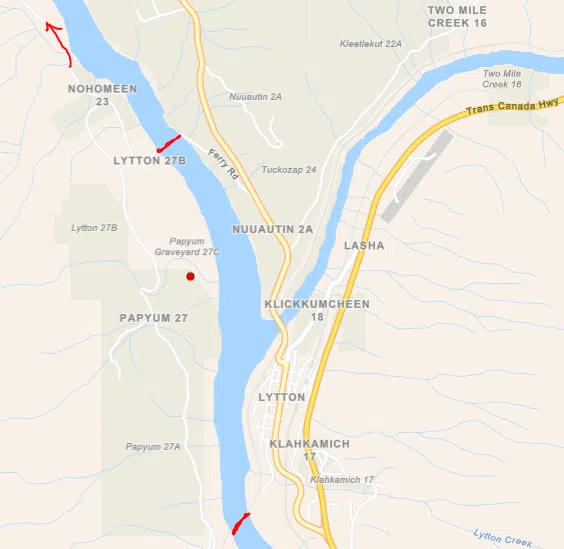
Map showing location of Nikaia Creek wildfire. Red line across Fraser River to north indicates Lytton Ferry crossing, red line to south indicates CN pedestrian bridge (no vehicle access) and red arrow north represents only vehicle bridge access to affected area, about 45 kilometers north at Lillooet/via BC Wildfire Service


Comments